Guide
Islamabad Master Plan Explained (2026): Zones, Amendments & What Investors Must Know

By wajahat Ali
Real Estate Analyst
Updated 18 min read
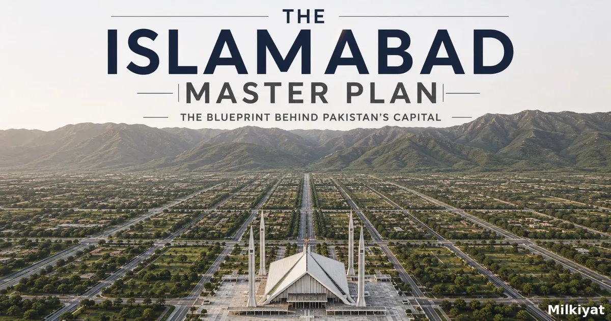
Islamabad is one of the very few capital cities on Earth that was drawn on paper before a single brick was laid. In 1960, a Greek architect sketched a city that would grow in one deliberate direction like an arrow, not a puddle. Sixty-six years later, that drawing still decides which housing society is legal, which plot can never be built on, and why two properties a kilometre apart can differ in value by millions of rupees.
Yet most buyers in the twin cities have never actually read what the Islamabad Master Plan says. This guide fixes that. We break down the original Doxiadis design, the five zones that control every square foot of the Islamabad Capital Territory (ICT), the 51 amendments that have quietly reshaped the city, the revision saga that remains stalled in 2026 and, most importantly, what all of it means for your money.
What Is the Islamabad Master Plan?
The Islamabad Master Plan is the founding urban blueprint of Pakistan's capital, prepared in 1960 by Doxiadis Associates, the firm of Greek architect and town planner Constantinos A. Doxiadis. When Pakistan decided to move its capital from Karachi to the Potohar Plateau, the government commissioned Doxiadis to design a city from scratch administrative, orderly, green, and deliberately separated from the commercial chaos of older cities.
The plan is administered by the Capital Development Authority (CDA), created under the CDA Ordinance 1960. Every layout plan approval, every NOC, every sector development in Islamabad flows from this document and its later legal instrument, the ICT (Zoning) Regulation 1992. If you have ever wondered why CDA-approved housing societies in Islamabad carry such a price premium, the answer begins here: approval means conformity with this master plan.
Two details from the original plan surprise almost everyone. First, Doxiadis's metropolitan framework initially included Rawalpindi the master plan area comprised Islamabad, the National Park, Rawalpindi, and the Cantonment, until ordinances separated Rawalpindi and its Cantonment from the plan in 1963. The twin cities were, on paper, one city first. Second, the plan's author built in an expiry mechanism: Doxiadis Associates recommended a comprehensive revision every 20 years a recommendation, as we will see, that has never once been honoured.
The "Dynapolis" Concept: A City That Grows Like an Arrow
Doxiadis rejected the classic circular city that grows outward in rings until its centre chokes. His alternative ,the Dynapolis ("dynamic city") grows along a single axis. Islamabad's spine runs southwest along what is now Srinagar Highway and Islamabad Expressway, with new sectors added in sequence as the city expands toward Rawalpindi. The city centre (the Blue Area) was designed to elongate with the city rather than get strangled by it.
The Sector Grid: Islamabad's DNA
The plan divides urban Islamabad into a grid of roughly 84 sectors, each about 2 km × 2 km, identified by a letter and number (F-7, G-11, I-8, and so on). Each sector was conceived as a self-contained community of around 20,000–40,000 residents, organised into four residential sub-sectors around a central commercial Markaz, with its own schools, mosques, parks, and health facilities. The lettered rows run parallel to the Margalla Hills:
- A, B, C series : largely unacquired/reserved land in the north and west
- D, E series : northern residential belt (E-7, E-11, D-12)
- F, G series : the city's prime, fully developed residential heart
- H series : institutions and industry (with major recent changes, covered below)
- I series : industrial and lower-cost residential sectors
The Five Zones of Islamabad: Where the Real Rules Live
For investors, the single most important part of the master plan framework is the zoning system formalised by the ICT (Zoning) Regulation 1992. The entire 906 sq km Islamabad Capital Territory is split into five zones, and the zone a property sits in determines who regulates it, what can be built, and how safe your title is.
Zone 1 : The Planned Core
Zone 1 contains the specified sectoral areas the lettered grid developed (or to be developed and acquired) by CDA itself. This is the Islamabad of postcards: F-6, F-7, G-9, I-8. Land here is acquired, developed, and allotted by CDA, which is why titles in Zone 1 sectors are considered the most secure in the country — and priced accordingly. Private housing schemes are generally not permitted inside Zone 1's sectoral areas.
Zone 2 : The Private Sector Frontier (Northwest)
Zone 2 covers unacquired sectoral land west of Zone 1 and was one of only two zones (alongside Zone 5) originally earmarked in 1992 for private-sector housing schemes developed by cooperative housing societies and private limited companies. Its flagship is Multi Gardens B-17 by the Multi Professional Cooperative Housing Scheme (MPCHS) — a CDA-approved society with direct M-1 Motorway access whose scale and development pace have made it the reference point for the entire zone.
A detail most guides miss: within Zone 1's unacquired sectoral areas, private housing schemes are prohibited with a single carve-out for Sector E-11. That exception is why E-11 is the only "sector" in Islamabad built by cooperative societies rather than CDA itself, and why its title chains behave more like Zone 2 societies than like F-series sectors, despite the Zone 1 address.
Zone 3 : The Protected Hills (No-Go for Construction)
Zone 3 encompasses the Margalla Hills National Park and adjoining areas. A blanket ban on private construction applies. In practice, this is one of the master plan's biggest open wounds: unregulated construction continues in localities such as Shah Allah Ditta, parts of Bhara Kahu, and a two-kilometre belt around Rawal Dam, because CDA has no regulatory mechanism for private land in the zone while residents insist on their right to build on their own property. Any plot marketed to you inside Zone 3 is a red flag of the highest order.
Zone 4 : The Giant (Where Most Societies Live)
Zone 4 is the largest zone in ICT roughly 69,814 acres stretching along the southeastern belt between Murree Road and Lehtrar Road: Islamabad Highway, Simly Dam Road, Park Road, and the Gulberg corridor. Notably, Zone 4 was not originally open to private housing at all; the federal government only permitted private housing and farm-housing schemes here in 2010. Gulberg Greens, Bahria Enclave, Park View City, and DHA Margalla Enclave in all sit in Zone 4 today. Read article For CDA crackdown on zone 3 and zone 4 Islamabad.
The Four Sub-Zones of Zone 4
Following the Supreme Court's suo motu case (SMC 10 of 2007), the 2010 revision of the zoning regulations divided Zone 4 into four sub-zones A, B, C, and D (with B further split into B-1 and B-2), each with different permitted land uses. No industry, livestock, or poultry farming schemes are allowed anywhere in Zone 4. Per the regulations as amended by the December 2014 gazette notification (SRO 1105(I)/2014):
| Sub-Zone | Primary Permitted Uses | Key Parameters |
|---|---|---|
| A | Agro-farming/orchard schemes, green belt projects, sports & recreation, public-sector housing schemes | Orchard schemes of 8 kanals |
| B (B-1 & B-2) | Small-scale residential and commercial schemes, regulated by CDA | Residential schemes of 50 acres; B-1 runs along Islamabad Expressway and Lehtrar Road, B-2 below Murree Road |
| C | Agro-farming and public-sector housing schemes | Farms of minimum 4 kanals; sub-zone spans 21,279 acres |
| D | Natural forest conservation, large agro-farming/orchard schemes, sports, recreation, entertainment zones, golf courses | Schemes of minimum 200 acres with farms of 4–20 kanals; sub-zone spans 23,618 acres |
This table is where most Zone 4 disputes are born: a marketer selling 5-marla residential plots on land that sits in an agro-farming sub-zone is selling a structural legal problem. The documentary standard does exist CDA's approval for Bahria Enclave Phase II (Mouza Phulgran) explicitly designates the scheme in Zone-4 (B), the residential sub-zone, in its plan reference itself. Also note that Gulberg sits at the junction of Zones 4 and 5 rather than purely inside Zone 4, with its Greens farmhouse blocks and Residencia residential blocks structured as different products for a reason. We break down every sub-zone's boundaries, permitted uses, and society verification status in our dedicated Zone 4 sub-zones guide. Our investigation into Blue World City's legal status shows how costly it can be to skip this verification.
Zone 5 : The Southern Belt
Zone 5 runs along the southern boundary of ICT toward the Rawalpindi district line, south of Islamabad Expressway. Private housing schemes are permitted with CDA approval. Because this belt physically merges into Rawalpindi's urban sprawl, jurisdiction confusion is common some nearby societies actually fall under RDA, not CDA. If you are unsure which authority governs a project you are considering, our explainer on RDA vs CDA jurisdiction resolves this in detail.
Zone Comparison Table
| Zone | Character | Private Housing Schemes? | Investor Risk Level |
|---|---|---|---|
| Zone 1 | CDA-developed planned sectors | No (CDA allotment only) | Lowest — premium prices |
| Zone 2 | Unacquired sectoral land, northwest | Yes, with CDA LOP + NOC | Moderate — verify NOC |
| Zone 3 | Margalla Hills, protected | No — blanket construction ban | Extreme — avoid entirely |
| Zone 4 | Largest zone; agro-farms + societies | Yes, per sub-zone rules | Moderate–High — check sub-zone & LOP |
| Zone 5 | Southern belt near Rawalpindi | Yes, with CDA approval | Moderate — confirm CDA vs RDA jurisdiction |
How Private Housing Got Legal, Zone by Zone: 1992 → 2010 → 2023
Per CDA's own public notices, the legal opening of ICT to private developers happened in three steps. In **1992**, the Zoning Regulation earmarked Zones 2 and 5 (plus Sector E-11) for private housing schemes. In 2010, the federal government extended private housing and farm-housing schemes to Zone 4. And in June 2023, the old "modalities and procedures" were replaced by a consolidated instrument — the Regulation for Planning and Development of Private Housing/Farm Housing, Apartments and Commercial Schemes/Projects in Zones-2, 4 & 5 of ICT, 2023 — which now governs every new LOP and NOC in these zones. If a society quotes approvals under the pre-2023 modalities, ask how its file was transitioned.
51 Amendments and Counting: How the Plan Was Changed Piece by Piece
Here is the uncomfortable truth at the heart of this story: Doxiadis Associates advised that the master plan be comprehensively reviewed every 20 years. That advice was never followed. Instead of full revisions, successive governments have made 51 selective amendments to the plan — most without expert consultation, and four under the current government alone.
The consequences are visible across the city. Sector I-8 was originally reserved as a transportation centre in the Doxiadis plan; it was converted into a residential sector decades ago, and the city later ended up building an electric bus depot on a greenbelt along Srinagar Highway instead. Meanwhile, Islamabad's built-up area exploded from roughly 2,693 hectares in 1990 to 18,465 hectares in 2020 — a nearly seven-fold expansion in thirty years, accompanied by both authorised and unauthorised housing schemes and even slum growth inside upscale sectors like F-6, F-7, and G-8.
The Big Recent Amendment: The H-Series Shake-Up
One of the most consequential recent changes came when the federal cabinet approved a package of master plan amendments affecting the H-series sectors. Sectors H-13, H-14, H-15, and H-17 — whose northern halves were originally reserved for green areas and buffer zones, with institutions in the south — were removed from Zone 1's acquisition framework and converted toward residential use under special regulations. Part of H-14 (the EME College and CMT Golra area) was even placed under the municipal jurisdiction of the Rawalpindi Cantonment Board, and the Srinagar Highway right of way north of H-13 was reduced from 1,200 to 800 feet.
Critics note that all of these changes were made without an active master plan commission — the body legally mandated to guide such revisions had expired in 2021 and was never replaced. For buyers, the practical takeaway is significant: the H-series northwest corridor is transitioning from institutional/buffer land into a regularised residential belt, which will reshape values across G-13, G-14, and adjoining societies.
The Revision Saga: Why Islamabad Still Has No Updated Master Plan in 2026
This is where the story becomes almost tragicomic. A timeline:
- 1960: Doxiadis plan approved; revision recommended every 20 years.
- 1986–92: First revision commission works for six years; its recommendations never receive Federal Cabinet approval. (The 1992 Zoning Regulation emerges from this period instead.)
- 2005–08: Second revision commission; same fate — no cabinet approval.
- 2017–18: The Supreme Court takes suo motu notice of irregular development in the capital; the Islamabad High Court, in its judgment of 9 July 2018, directs the government to form a commission to review the master plan.
- January 2019: The Interior Ministry notifies the commission. It produces the Interim Report on the Review of the Master Plan of Islamabad (2020–2040), adopted by the CDA Board in December 2019 and approved by the federal cabinet — introducing high-rise bylaws for the Blue Area and Mauve Area, first-ever building bylaws along Islamabad Expressway, Murree Road, Lehtrar Road, Fateh Jang Road, Park Road, and GT Road, a cut in the minimum housing-society area from 400 to 200 kanal, and Sector G-6 as a regeneration pilot. The comprehensive revision itself is left to an international consultant — which CDA never hires.
- 2021: The commission's composition is altered in August 2021; after the change of government, members quit or stop responding. It regularised construction in some areas (including Bani Gala) but left the broader revision undone.
- 2024: The cabinet considers a reconstitution summary in January and sends it back for a "well-thought-out proposal"; amended summaries follow in February (20 names) and September (cut to 15 names).
- February 2026: The latest summary proposes an 18-member commission, convened by the CDA Chairman, including urban planners, a water resources expert, the Surveyor General of Pakistan, and ex-officio members such as the DG RDA.
- June 2026: Still stalled. CDA confirms the file sits with the federal government, which alone can notify the commission. Meanwhile, development projects highways, interchanges, buildings continue at full speed under the old, patched-up plan.
The irony is hard to miss: Islamabad remains celebrated as one of the world's best-planned capitals, green, orderly, comparatively clean while operating on a 66-year-old document whose author said it should be overhauled every twenty years. Three commissions have now tried , 1986, 2005, and 2019 and none has delivered a completed, cabinet-approved revision. A city famous for planning has spent four decades unable to plan its own plan.
How to Check Which Zone (and Sub-Zone) Your Plot Falls In
Four steps, in order of increasing certainty:
- Get it in writing from the developer. Ask for the zone, sub-zone, LOP approval number, and NOC status on letterhead. A society that hesitates here has answered your question.
- Check the CDA housing schemes portal. CDA's official website lists private housing schemes with their zone, road, and area search the society name at cda.gov.pk under housing schemes.
- Cross-check the land record. Match the plot's mouza and khasra numbers (from the developer's title documents) against the scheme's approved LOP with the Directorate of Regional Planning, CDA. This is the step that catches "extension blocks" launched outside the approved layout.
- Confirm the regulator on the boundary. Along the southern belt and airport corridor, many marketed "Islamabad" societies actually fall in Rawalpindi district under RDA. If jurisdiction is unclear, resolve it before anything else.
What the Master Plan Means for Property Investors in 2026
Urban planning history is interesting; protecting your capital is essential. Here is how the master plan translates into practical investment rules:
1. The Zone Decides the Regulator and the Risk
Before you look at plot prices, payment plans, or marketing brochures, establish which zone (and sub-zone) the land falls in. A society on Zone 4 agro-farming sub-zone land selling 5-marla residential plots is a structural legal problem no discount can fix. And on the Rawalpindi side of the boundary, the regulator changes entirely — a distinction we unpack in our guide to choosing between RDA and CDA jurisdiction for investment.
2. Master Plan Conformity Is What an NOC Actually Certifies
An approved Layout Plan (LOP) means CDA has verified the project's design against the master plan and zoning regulations; the NOC confirms all LOP conditions were met. This two-step logic is why we maintain a strictly verified list of legal, CDA-approved societies in Islamabad rather than reprinting developer claims.
3. Amendments Create Winners If You Read Them Early
Master plan amendments move markets before ground reality changes. The H-series conversion to residential status, the regularisation provisions for H-13 buildings, and the reduced Srinagar Highway right of way all reprice surrounding land years before construction catches up. Investors who track cabinet decisions and CDA board minutes consistently buy ahead of the curve.
4. Zone 3 Is Not a Bargain It Is a Trap
Plots in and around Shah Allah Ditta, Bhara Kahu's restricted pockets, or the Rawal Dam belt are sometimes marketed at "pre-regularisation prices" on the theory that the new commission will legalise them. That is speculation on a government decision that has been pending for five years. The construction ban is the law today; buy accordingly.
5. The Coming Revision Is the Biggest Event on the Horizon
Whenever the new commission is finally notified, its decisions on Zone III regulation, rural-area building controls (Tarnol, Lehtrar Road, the Expressway belt), and new sector development will be the single largest repricing event in the twin cities market since the Ring Road alignment was finalised. Milkiyat.com will cover the commission's notification and its first decisions as they happen — bookmark our research desk for updates.
Frequently Asked Questions
What is the Islamabad Master Plan?
It is the original urban blueprint of Pakistan's capital, prepared in 1960 by Doxiadis Associates. It governs zoning, sector development, and land use across the Islamabad Capital Territory and is administered by the CDA under the CDA Ordinance 1960 and ICT (Zoning) Regulation 1992.
Who designed Islamabad's master plan?
Greek architect and town planner Constantinos A. Doxiadis and his firm Doxiadis Associates, using the "Dynapolis" model of directional urban growth.
How many zones does Islamabad have?
Five. Zone 1 (CDA planned sectors), Zone 2 (private schemes, northwest), Zone 3 (Margalla Hills — construction banned), Zone 4 (the largest zone — agro-farms and approved societies), and Zone 5 (southern belt toward Rawalpindi).
Has the master plan ever been fully revised?
No. Despite Doxiadis's recommendation of a review every 20 years, three commissions (1986–92, 2005–08, 2019–21) failed to deliver a completed, cabinet-approved revision; 51 selective amendments were made instead. A new 18-member commission proposed in February 2026 had still not been notified by the federal cabinet as of June 2026.
What are the sub-zones of Zone 4?
Zone 4 has four sub-zones — A, B (split into B-1 and B-2), C, and D — created by the 2010 revision after Supreme Court case SMC 10 of 2007. Sub-zones A, C, and D are primarily for agro-farming, forests, and recreation (with public-sector housing allowed in A and C), while sub-zone B permits small-scale private residential and commercial schemes. No industry, livestock, or poultry farming is allowed anywhere in Zone 4.
Which zone is best for property investment?
Zone 1 offers the most secure (and expensive) titles. Zones 2, 4, and 5 host most private societies at accessible prices — but only societies with an approved LOP and issued NOC should be considered. Zone 3 should be avoided entirely.
Can I build in Zone 3?
No — a blanket construction ban applies to Zone 3. Ongoing unregulated construction there exists in a legal grey zone that the pending master plan revision is expected to address, but buying on that hope is high-risk speculation.
Milkiyat.com is a real estate research platform covering the Islamabad–Rawalpindi twin cities market. All regulatory information in this article is drawn from CDA records, federal cabinet decisions, and reporting by Dawn and Pakistan Today as of July 2026. Verify current approval statuses directly with the CDA before any transaction.