Blog
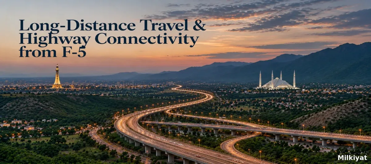
Long-Distance Travel & Highway Connectivity from F-5

By Maham Imtiaz
Real Estate AnalystVerified author
Updated 13 min read
Short Answer:
New Islamabad International Airport is about 30 km from F-5 along Srinagar Highway, so allow 40 to 55 minutes door to terminal. The nearest Islamabad Expressway access point is Zero Point, roughly 4 km south. The M-2 for Lahore and M-1 for Peshawar branch off Srinagar Highway about 25 km out, and PIMS in G-8/3 is 8 km away on a signal-free run.
F-5 sits in the oldest, most central band of Islamabad, bordered by city avenues rather than highways, with Blue Area, the Red Zone, and the Margalla foothills all on its doorstep. That central position shapes how residents reach the airport, the motorways, and the capital's main hospitals, even though no intercity route touches the sector itself. For a quick look at F-5's sub-sectors, landmarks, connectivity, and property market, see F-5 at a glance before planning longer journeys from the sector.
The Three Gateways That Define F-5's Reach
Islamabad's sector grid was designed so that residential blocks never sit directly on a highway. F-5 is a clean example. Its four edges, Margalla Road at the top, Ataturk Avenue to the west, Constitution Avenue to the east and Jinnah Avenue at the bottom, are all city avenues, not intercity routes. Nothing with a motorway number touches the sector.
What F-5 has instead is short, reliable access to three gateways, and understanding which one to use is most of what long-distance travel from this sector involves.
The first is the Serena junction, where Jinnah Avenue and Ataturk Avenue feed into Srinagar Highway. This is the airport gateway, the motorway gateway, and the route to every western sector. From most F-5 addresses it is a two to four minute drive.
The second is Zero Point, roughly 4 km south, where Srinagar Highway meets the Islamabad Expressway and Faisal Avenue. This is the gateway to Rawalpindi, GT Road, Murree and everything to the south-east.
The third is Margalla Road running west along the sector's northern boundary, which carries you above the F-series towards E-11, D-12 and the northern exits.
For everything inside the city, commercial hubs, government offices, transit stations, start with The Complete F-5 Islamabad Commuter Guide: Transit, Routes, and Accessibility, the parent guide this article belongs to. This piece covers only what happens once you leave the capital.
How Far Is F-5 Islamabad from New Islamabad Airport
This is the single most asked question by anyone considering F-5, because the answer changed dramatically in 2018 when the old Benazir Bhutto International Airport in Rawalpindi closed and operations moved to the new facility near Fateh Jang.
The distance: roughly 30 km from the centre of F-5 to the terminal building. The old airport was under 15 km. Every household in the sector effectively doubled its airport run overnight.
The route: exit F-5 at the Serena junction onto Srinagar Highway and stay on it. The highway runs 25 km west from its eastern end to the Airport Interchange, passing Peshawar Mor, Golra Sharif, the GT Road Interchange and the Motorway Interchange along the way. It is signal-free for almost its entire length. There is no meaningful alternative and no shortcut worth attempting, every other route is longer.
Realistic timing: 40 to 55 minutes door to terminal in normal conditions. Between 7:30 and 9:30 in the morning, and again from 4:30 to 7:00 in the evening, the stretch between Peshawar Mor and Golra Sharif slows considerably. For an international departure requiring a three-hour check-in, an F-5 household should be leaving four hours before scheduled departure, and four and a half if the flight is on a Friday afternoon.
Things worth knowing before you leave:
- Terminal entry is controlled. Only ticketed passengers pass the entrance gate, so anyone seeing you off stops at the drop-off point.
- Parking is paid and tiered by duration, with short-stay bays near the terminal and long-stay areas further out. If you are leaving a car for a week, budget for it rather than being surprised.
- Flight schedules, parking rules and entrance-gate procedure are all published by the operator, and the official Islamabad International Airport passenger information pages are the only version of those rules that is actually current.
- Ride-hailing coverage from F-5 to the airport is dense and reliable at any hour. For a single traveller, this is almost always cheaper than a week of airport parking.
- Fog is the real variable. Between late December and early February, morning visibility on the western half of Srinagar Highway can add half an hour with no warning.
Islamabad Expressway Access Points Near F-5
The Islamabad Expressway runs 28 km from the Zero Point Interchange to Rawat on the N-5 National Highway, and it is the capital's busiest commuter artery. For an F-5 resident, the useful thing to understand is that there is really only one entry point that matters.
Zero Point Interchange is the nearest and, in practice, the only sensible Expressway access point near F-5. It sits about 4 km south of the sector, reached either by Jinnah Avenue east to Constitution Avenue and then south, or by Faisal Avenue from the Srinagar Highway side. Everything on the Expressway, Koral, Khanna Pul, Gulberg, Rawat, is measured from here.
Once you are on it, the corridor gives F-5 direct access to Bahria Town, DHA Islamabad, Gulberg Greens, the Soan valley societies and, at its southern end, T-Chowk Rawat where the N-5 takes over towards Jhelum and Lahore by the old route.
Two practical notes. First, the Expressway's northbound morning peak and southbound evening peak are severe, and a trip that takes 25 minutes at 11 a.m. can take an hour at 6 p.m. Second, F-5 residents heading to Murree normally use the Expressway only as far as the Faizabad area before switching to the E-75 Murree Expressway through Bhara Kahu, though on weekends, the Margalla Road and Bhara Kahu approach along the sector's northern edge is often the faster start.
Motorway Access: M-1, M-2 and the Interchange That Serves F-5
Long-haul road travel from Islamabad runs on two motorways, and both are reached the same way.
The Motorway Interchange on Srinagar Highway, roughly 25 km west of F-5 and just short of the airport, is where the network begins. Take the south exit for the M-2 to Lahore, a 375 km run that most drivers complete in four to four and a half hours. Take the north exit for the M-1 to Peshawar, 155 km, typically under two hours.
From those two spines, the rest of the country opens up. The M-1 connects at Hakla to the M-14 for Dera Ismail Khan, and at Burhan to the N-35 Hazara route for Abbottabad and Gilgit-Baltistan. The M-2 connects at Pindi Bhattian for Faisalabad and Multan, and continues into the southern network beyond Lahore.
For an F-5 household, this means the practical drive-time map of Pakistan looks roughly like this: Lahore in four and a half hours, Peshawar in two, Abbottabad in two and a half, Faisalabad in four, Multan in six and a half. Add 40 minutes to each for the run out of the city.
Two things are worth building into your planning. Tolls on the motorway network are collected electronically, and an M-Tag is effectively mandatory for regular travel. And the Rawalpindi Ring Road, which partially opened in April 2026, has changed the picture for traffic coming from the GT Road side of the twin cities, its Chakri interchange puts the airport around 20 minutes away, and its Banth interchange near Rawat connects to the N-5. The Thalian interchange that would link the Ring Road directly to the M-2 has been deferred to a later phase, with an interim widening arrangement in place, so F-5 traffic still uses the Srinagar Highway approach for motorway trips.
A second project matters for the sector's future reach. Margalla Road currently terminates near D-12, which forces traffic from the F, G and H sectors onto Srinagar Highway or IJP Road to reach the motorway. A CDA-executed link from GT Road to Sangjani, paired with a Punjab-executed extension to the motorway and an NHA segment near AWT, is intended to give northern Islamabad direct M-1 access. If it completes as scheduled, F-5's Margalla Road edge becomes a genuine second highway gateway rather than just a scenic boundary road.
F-5 Islamabad to PIMS Hospital Route
Emergency medical routing deserves its own section, because the decisions are made under pressure and the wrong turn costs real time.
The Pakistan Institute of Medical Sciences on Ibn-e-Sina Road in G-8/3 is the capital's principal public tertiary hospital, with a 24-hour emergency department, a major trauma centre and a helipad on site. For F-5, it is the closest facility of that class.
Route: from F-5, take Jinnah Avenue west through Blue Area and continue onto Srinagar Highway. Stay westbound past the 7th Avenue and Faisal Avenue junctions, then exit south onto Ibn-e-Sina Road, which runs into G-8/3 and delivers you to the hospital's emergency block.
Distance and time: roughly 8 km. Fifteen to twenty minutes off-peak, and rarely more than twenty-five even in heavy traffic, because the entire route is on signal-free avenues.
Alternative approach: if Jinnah Avenue is congested, use Margalla Road west along the sector's northern boundary, then turn south on 7th Avenue and pick up Ibn-e-Sina Road from the north. Slightly longer in distance, often faster at 6 p.m.
Worth knowing: departmental timings, emergency arrangements and contact numbers are published by the institute itself, and the PIMS official website is the right place to confirm them before a non-urgent visit. For private care, Shifa International in H-8/4 sits on the same westward corridor about 10 km out, and there are smaller private hospitals in F-8 and G-8 that are closer still for non-critical cases. The point of knowing the PIMS route precisely is that it is the one you take when there is no time to think.
Doing Long-Distance Trips Without a Car
F-5 is unusually well served for a sector with no highway frontage.
The Metrobus Red Line terminates at Pak Secretariat on the sector's southern edge, and runs to Saddar in Rawalpindi. From Faizabad and Saddar, the intercity bus network, including the Daewoo terminal on the Rawalpindi side, covers Lahore, Peshawar, Multan and the northern routes. The full station-by-station picture is in The F-5 Public Transportation & Metro Guide.
For the airport specifically, the honest answer is that public transport is not competitive. Airport shuttle and ride-hailing services are what F-5 residents actually use, and the cost difference against a week of parking usually settles the argument.
For travel within the Red Zone and to the government and cultural institutions on F-5's doorstep, none of the above applies, those trips are covered separately in Commuter Routes to Government, Judiciary & Cultural Landmarks.
What This Means If You Are Buying or Renting in F-5
Highway connectivity is where F-5's location argument gets tested, and it is worth being straight about the trade-off.
The sector loses on airport proximity. A buyer choosing between F-5 and a society on the Srinagar Highway corridor near Golra or Tarnol is choosing between a 30 km airport run and a 12 km one. For a household that flies twice a month, that is a real cost.
What F-5 gains is centrality. Being 4 km from Zero Point and 3 km from the Srinagar Highway entry means that no direction is closed off. The Expressway corridor, the motorway network, GT Road, Murree and the airport are all reachable without crossing the city first, which is exactly what residents of the eastern and far-western societies spend twenty minutes doing before their journey properly begins.
For the frequent flyer, the calculation is about buffer time rather than distance: build in four hours for an international departure and F-5 works perfectly well. For the out-of-city business traveller who drives to Lahore or Peshawar monthly, the sector is close to ideal, 40 minutes to the motorway gate, and no city traffic on the way back in. And for anyone weighing medical access, an 8 km signal-free run to a tertiary emergency department is a genuine and underrated advantage of living in the middle of the grid.
Frequently Asked Questions
Q1. How far is F-5 Islamabad from New Islamabad Airport?
A. About 30 km, almost entirely along Srinagar Highway. Allow 40 to 55 minutes door to terminal in normal conditions, and four hours before departure for an international flight once check-in time is added.
Q2. What is the nearest Islamabad Expressway access point to F-5?
A. The Zero Point Interchange, roughly 4 km south of the sector, where Srinagar Highway meets the Expressway and Faisal Avenue. It is the practical entry point for the entire 28 km corridor down to Rawat.
Q3. How do I get from F-5 onto the motorway for Lahore or Peshawar?
A. Take Srinagar Highway west for about 25 km to the Motorway Interchange. The south exit is the M-2 for Lahore, the north exit is the M-1 for Peshawar. Carry an M-Tag for the toll gates.
Q4. What is the fastest route from F-5 to PIMS hospital?
A. Jinnah Avenue west onto Srinagar Highway, then south onto Ibn-e-Sina Road into G-8/3. Roughly 8 km and 15 to 20 minutes. If Jinnah Avenue is blocked, use Margalla Road and come down 7th Avenue instead.
Q5. Has the Rawalpindi Ring Road changed travel times from F-5?
A. Not directly. The Ring Road mainly helps traffic on the GT Road and Adiala side of Rawalpindi. F-5 trips still run through Srinagar Highway, and the Thalian interchange linking the Ring Road to the M-2 has been deferred to a later phase.
Q6. Is F-5 a good sector for someone who travels frequently?
A. For road travel, yes, the motorway gate is 40 minutes away with no cross-city driving involved. For air travel, it is average rather than strong, because the airport move to Fateh Jang put every central sector about 30 km out.
Sources
- Islamabad International Airport — official passenger and airport access information, Pakistan Airports Authority
- Islamabad International Airport — parking information
- Islamabad International Airport — entrance gate procedure
- Islamabad International Airport — flight schedules
- National Highway Authority — motorway and national highway network
- National Highway Authority — network maps, M-1 and M-2 route sheets and toll notifications
- Pakistan Institute of Medical Sciences (PIMS) — official website
- Capital Development Authority — Islamabad transit map and feeder route schedules
- Punjab Mass Transit Authority — Pakistan Metrobus System
- Rawalpindi Development Authority — private housing schemes and corridor development records