News
Rawal Dam Spillways Opened for the Third Time This Year After Reservoir Nears Capacity

By Mariam Khan
Real Estate Analyst
4 min read
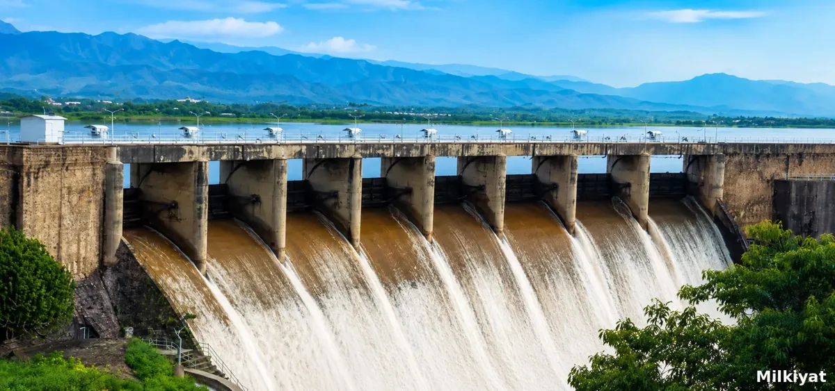
Islamabad's district administration opened the Rawal Dam spillways at 2pm on 1 September 2026 after heavy rainfall pushed the reservoir to 1,751.90 feet, close to its maximum storage capacity of 1,752 feet. Rescue 1122, police, and other departments were placed on alert, while residents were warned to avoid drains and low lying locations. This marks the third time this year that the dam's spillways have needed to be opened.
Why Rawal Dam Fills So Quickly
Rawal Dam is one of three main dams supplying water to the twin cities, alongside Simly and Khanpur, with Rawalpindi city and Cantonment drawing from Rawal and Khanpur specifically. Rawal Dam's total storage capacity is comparatively modest at roughly 1,752 acre feet, meaning even a single intense spell of monsoon rainfall across its catchment can push the reservoir from a safe operating level to near maximum capacity within days. When that happens, authorities have no choice but to open the spillway gates and release water downstream to prevent the dam itself from being compromised, a controlled release rather than an uncontrolled failure, but one that sends a significant volume of water into the downstream waterway system regardless.
Where the Released Water Actually Goes
Water released through Rawal Dam's spillways flows into the Korang Nullah, and authorities have specifically urged residents living along this waterway to remain vigilant, avoid crossing the nullah, and stay away from any temporary bridges constructed over it during periods of increased water flow. This is a standard, recurring precaution during spillway releases, since the sudden increase in water volume and flow speed downstream can turn a normally manageable crossing into a genuine hazard within a short period.
A Documented, Recurring Pattern With Real Consequences
This is not an isolated event, and its history carries real weight. During a previous, more severe episode, torrential rain of similar scale caused catastrophic urban flooding across Islamabad, including in Sector E-11, where a woman and a young child died after floodwater entered a basement in the sector, an event connected to the same broader pattern of dam capacity, nullah overflow, and basement vulnerability that this week's spillway opening again raises. That history is directly relevant to why authorities respond to Rawal Dam nearing capacity with genuine urgency rather than routine caution, and why residents along Korang Nullah and other connected waterways are advised so specifically to stay clear during active releases.
The Broader Dam System Under Pressure
Rawal Dam does not operate in isolation. During comparable periods of sustained monsoon rainfall, Khanpur Dam and Simly Dam have simultaneously approached their own near maximum capacity levels, reflecting how a single significant rainfall event across the twin cities' shared catchment area places pressure on the entire regional water storage system at once, not just Rawal Dam alone. This is directly connected to the broader Lai Nullah basin dynamics already documented elsewhere in Islamabad and Rawalpindi's monsoon season, where the same Margalla Hills catchment feeds multiple downstream waterways simultaneously.
What This Means for Property Along Downstream Waterways
Property owners and residents along Korang Nullah, and more broadly anyone in low lying areas connected to Islamabad and Rawalpindi's shared drainage and dam system, should treat a Rawal Dam spillway opening as a direct, immediate signal of elevated short term flood risk, not a routine administrative announcement. Given that this is the third such opening this year, and given the documented, serious consequences of comparable past events, buyers and current property owners near any of these connected waterways should treat proximity to Korang Nullah, and downstream flood exposure more broadly, as a genuine, recurring due diligence item rather than an occasional seasonal concern. This reinforces the importance of verifying nullah buffer distance, drainage capacity, plot elevation, and basement specific flood risk directly for any property in these corridors, precisely the kind of verification milkiyat.com has already covered in detail following the E-11 sector flooding earlier this week, and one that matters most in the specific weeks following a spillway release like this one.
Sources
- Wikipedia, Lai Nullah: https://en.wikipedia.org/wiki/Lai_Nullah
- Wikipedia, Khanpur Dam: https://en.wikipedia.org/wiki/Khanpur_Dam
- Wikipedia, Simly Dam: https://en.wikipedia.org/wiki/Simly_Dam