Guide
Faisal Town Phase 2 Location: Drive Times to the Airport, Thalian, Chakri and G-13
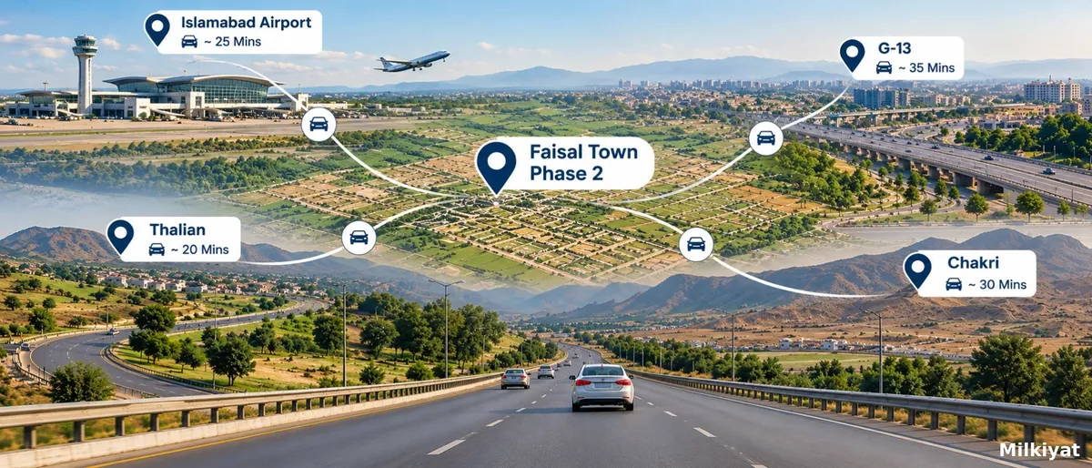

This guide covers location and access. For the Ring Road's timeline and price impact, see our Ring Road guide.
Overview
The Faisal Town Phase 2 location is the scheme's strongest selling point, and it's almost always described in minutes. Those minutes come from the developer. Nobody we found has published a measured drive.
This guide sets out where the scheme is, which roads reach it, and what each source claims about the airport, the Thalian Interchange and Chakri Road. For the scheme as a whole, see our Faisal Town Phase 2 guide.
If you'd rather see what is for sale near these roads, the Faisal Town Phase 2 listings page shows current asks. One caution: the developer's own pages say the Phase 2 NOC is not yet approved by the Rawalpindi Development Authority (RDA).
The short answer
- The land is at Mera Kalan, Kolian Par and Dhalla in Tehsil Rawalpindi, beside the M-2 Motorway and Chakri Road.
- The developer claims 2 minutes to Chakri Road, 4 to the Thalian Interchange and 5 to the airport. None is measured.
- Milkiyat's own guides disagree on the nearest Ring Road interchange and on the airport time.
- No source gives a time to G-13. You'll have to measure it.
Where is Faisal Town Phase 2?
The developer calls it "a prime spot near the Thalian Interchange on the M-2 Motorway" and says the land is parallel to the motorway and Chakri Road. It adds that a 12 km patch of the motorway runs alongside.
The land sits at Mera Kalan, Kolian Par and Dhalla, the three mouzas named in the RDA's show-cause notice of 31 October 2023, reported by the Associated Press of Pakistan. They are in Tehsil Rawalpindi. The developer says Islamabad is 15 to 20 minutes away, "depending on the route".
Faisal Town Phase 2 location map: what the developer gives you
The developer's Phase 2 page carries an embedded map centred near 33.49°N, 72.86°E, a map link in its FAQs and an image titled "Faisal Town 2 Accessibility". It gives no street address and no written directions.
We can't say the map pin marks an entrance. The land is large, and different blocks may be reached differently. Ask the sales team for a location pin for your block, not just for the scheme.
The developer's head office is a separate place. It lists Faisal Tower on Main Fateh Jang Road, near Tarnol Interchange, Rawalpindi. Don't navigate there expecting to see the land.
What the developer says about drive times
| Destination | Developer's claim |
|---|---|
| Chakri Road | 2 minutes |
| Thalian Interchange | 4 minutes |
| M-2 Motorway | 4 minutes |
| Rawalpindi Ring Road | 5 minutes |
| Islamabad International Airport | 5 minutes |
| Girja Road | 9 minutes |
| Srinagar Highway | 11 minutes |
| M-1 Motorway | 15 minutes |
| Islamabad | 15 to 20 minutes |
None of these says where the clock starts, what time of day it is or which route is used. They read as best-case figures.
Milkiyat.com finding: our own sources don't agree
We compared the developer's page with two Milkiyat guides that describe the same location:
| Question | Developer | Milkiyat Faisal Town Phase 2 guide (updated 3 Oct 2026) | Milkiyat Ring Road route guide (updated 2 Oct 2026) |
|---|---|---|---|
| Time to the airport | 5 minutes | 5 to 10 minutes | Not given |
| Nearest Ring Road interchange | Thalian, 4 minutes | "Immediately adjacent" to Thalian | Chakri Road |
| Length of motorway frontage | 12 km | 10 km | Not given |
| Ring Road position | 5 minutes away | "Slices directly through" the layout | Near the Chakri interchange |
None of these is a measurement. We're showing the spread, not resolving it. The airport time alone differs by up to double between the developer and our own guide. A reader who compares pages will see that, which is a good reason to measure rather than quote.
Faisal Town Phase 2 distance from airport
No approved source we found gives a distance in kilometres. The developer says 5 minutes. Our scheme guide says 5 to 10 minutes via Airport Avenue.
A single figure hides a lot. The scheme has a long motorway frontage, so the time from one end may differ from the other. Traffic, the route and the starting point all change the answer. A drive from your block's entry is the only number worth using.
Thalian Interchange and Chakri: which one matters?
"Chakri" means two things here. Chakri Road is the road along the scheme's southern side. The Chakri Road interchange is one of five on the Rawalpindi Ring Road.
The Thalian Interchange is where Phase I of the Ring Road meets the M-2 Motorway. Dawn put the new interchange at about Rs5 billion and reported on 3 October 2026 that its revised project proposal wasn't final. The road is meant to open without it, using a two-way carriageway to the motorway.
The Express Tribune reported on 18 August and 14 September 2026 that the Chakri Road interchange is complete and Thalian isn't. If your plot is nearer Chakri, the unfinished Thalian work may matter less. We can't tell from public sources which interchange is closer to which block. Our Rawalpindi Ring Road guide covers the route.
How to reach Faisal Town Phase 2
The developer's wording points to three approaches:
- Chakri Road. The developer says it is 2 minutes from the scheme.
- The M-2 Motorway, leaving at the Thalian Interchange. The developer says 4 minutes.
- The Rawalpindi Ring Road. As of 3 October 2026, Dawn reported the road built but not open, so don't plan a trip around it yet.
Whichever you choose, put your block's pin into a maps app before you set out. There's no street address to rely on.
How to measure the drive yourself
- Pick one starting point and write it down. For G-13, use your own gate or a fixed landmark.
- End at the entry of your block, not the scheme's name on a map.
- Drive at three times: a weekday morning peak, midday and the evening peak.
- Note the route each time, and repeat the drive on a second day.
- Record the airport, Thalian, Chakri Road and G-13 separately.
- Compare your times with the developer's table above.
No source gives a G-13 figure, so your numbers would be the first.
Why location claims need care
Three habits make location claims hard to trust.
First, the clock. A time is quoted from an unstated start, so two sellers can give different answers for the same road.
Second, comparison. Our scheme guide names Capital Smart City and Blue World City as other societies on the Chakri Road and Thalian corridor. Each will describe its own location in its own best case. If you compare, use the same start point and the same method for every one.
Third, the mouza names. Mera Kalan, Kolian Par and Dhalla matter beyond directions. They are the names in the RDA's 2023 notice, so they're also the names to search when you check the land's approval status.
What to ask the sales team
- A location pin for your own block's entry, not for the scheme.
- Which road and which interchange the entry is reached from.
- Whether the access road to your block is built and open today.
- The starting point and route behind any drive time you're quoted.
- Whether the quoted time depends on the Ring Road, which isn't open yet.
- Their answer in writing, so you can compare it with your own drive.
Red flags
- A time quoted with no starting point or route.
- A map pin that marks a different scheme or a main road.
- "It's approved because it's on the M-2."
- Photos of the airport or motorway used as proof of distance.
FAQs
Are the drive times in this guide measured?
No. Every time here is a claim by the developer or by one of our own guides. We found no published measurement and say so, so you can drive it yourself.
Where is the Faisal Town Phase 2 location?
At Mera Kalan, Kolian Par and Dhalla in Tehsil Rawalpindi, beside the M-2 Motorway and Chakri Road, near the Thalian Interchange, according to the developer.
Is there an official Faisal Town Phase 2 location map?
The developer embeds a map and links to one, but gives no street address. Ask for a pin for your block.
What is the Faisal Town Phase 2 distance from airport?
The developer says 5 minutes and our scheme guide says 5 to 10. Neither is a measurement, and we found no distance in kilometres.
How to reach Faisal Town Phase 2?
Use Chakri Road or the M-2 Motorway via the Thalian Interchange. The Ring Road isn't open yet.
What is the Thalian Interchange?
It's where the Rawalpindi Ring Road's first phase meets the M-2 Motorway. The new interchange is unfinished.
How far is Faisal Town Phase 2 from G-13?
No source gives a figure. Measure it from your own starting point, at peak and off-peak hours.
Does a good location mean the scheme is approved?
No. The developer's own pages say the NOC isn't approved. Check our guide to verifying a Faisal Town Phase 2 file.